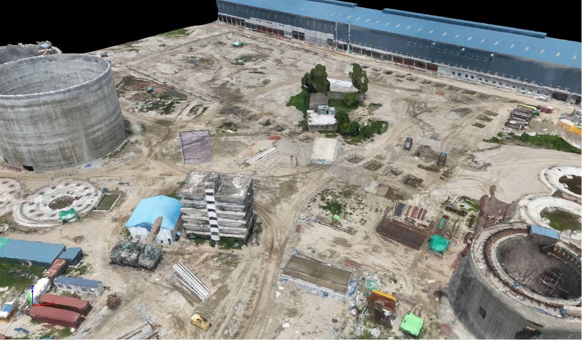
I am an experienced drone image processing expert, providing tailored geospatial solutions across various industries, including urban planning, construction, and environmental monitoring. With a strong focus on delivering high-precision results, I specialize in turning aerial data into actionable insights using industry-leading tools like Agisoft Metashape and Pix4D.
My Services Include:
- Drone Image Processing & 3D Map Generation: I produce accurate 3D models and maps from drone-captured data for land development, infrastructure planning, and environmental analysis.
- Orthophoto Creation & Georeferencing: High-resolution, georeferenced orthophotos provide a detailed view of the terrain, perfect for GIS analysis, site inspections, and land surveys.
- Digital Surface Models (DSM) & Digital Terrain Models (DTM): These models offer a clear view of the surface and terrain, aiding in construction planning, flood risk analysis, and topographic surveys.
- Point Cloud Generation & Contour Plan Creation: My detailed point clouds and contour plans offer valuable insights for volumetric analysis, terrain mapping, and site planning.
- Volume Calculations & Area Measurements: I provide accurate volume and area measurements for construction, excavation projects, and land surveys.
- Ground Control Points (GCP): For the highest precision, I use GCPs to enhance accuracy, ensuring that drone data aligns with real-world coordinates.
Industries Served:
- Urban Planning: Zoning, city development, and infrastructure planning.
- Construction: Site inspection, volume tracking, and project management.
- Environmental Monitoring: Land use, flood risk, and vegetation monitoring.
- Agriculture: Precision farming, crop health, and land use planning.
- Mining: Volumetric analysis and progress tracking.
Why Work with Me?
- Proficient in Agisoft Metashape and Pix4D for complex drone data.
- Focus on accuracy with GCPs for high-precision outputs.
- Customized solutions to meet your specific project goals.
- Timely delivery with a commitment to quality.
Let’s collaborate to turn your aerial data into valuable, actionable insights. Whether you’re planning a construction project, conducting environmental monitoring, or need detailed topographic maps, I’m here to help!